As the LARSOCS project enters its fifth month, we take a look at the University of Malta’s Electronic Systems Engineering Department’s role in the project.
 Archaeology is an area overflowing with opportunities for interdisciplinary research and collaboration, and LARSOCS, which stands for Low Altitude Remote Sensing Over Compact Sites, is very much proof of that. In fact, as we reported back in December in the post LARSOCS – Endless Potential, archaeology proved to be the perfect starting point for the creation of equipment that could yield new knowledge about Malta’s environment, history and anthropology while also giving numerous departments within the UoM new equipment to work on and with.
“As a joint effort between the Department of Classics & Archaeology, the Department of Electronics Systems Engineering (DoESE), and the Institute of Earth Sciences, as well as the help of Dr Gianmarco Alberti from Italy, the LARSOCS project is bringing together a myriad of skills together to tackle one of local archaeology’s biggest headaches,” explains Dr Ing. John Betts, who, on top of being the coordinator of the project, is also a senior lecturer and the only engineer within the Faculty of Arts.
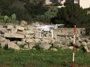
Since the project first kicked off at the beginning of October, the team has purchased the drone, which will be used to map two historical sites from an altitude of less than 50 metres. That was the first part of the project, with the second seeing the various departments work on creating a system by which the drone can follow carefully-laid markers on the ground under a tent that will protect sites and archeologists working on them from the elements.
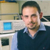
Dr Ing Marc Anthony Azzopardi
“For the time being, we are looking at developing the hardware,” explains Karl Galea, a graduate from the DoESE whose thesis focused on localisation systems for miniature quadcopters. “Basically, we’re adding microphones to the drone, as well as a processing board, to help the drone localise itself by using ultrasound.”
Through this mapping, archaeology students from the Department of Classics & Archaeology will be able to save time from snapping the areas themselves, while the imagery produced will allow them to create detailed and accurately-scaled 3D models of the sites.
“Localisation systems are extremely useful for the drone application, and for mobile robotic systems in general,” explains Dr Ing. Marc Anthony Azzopardi, a lecturer and researcher at the DoESE. “Getting a drone to behave autonomously the way you want and need it to is, of course, much more complicated than simply getting it to fly.
“It needs to be able to accurately localise itself but the equipment needed to do that cannot be too cumbersome or heavy, or else it becomes impractical and infeasible. Moreover, we’re working on equipping the drone with a Local Position System (LPS) rather than a Global Positioning System (GPS), so it can work independently of satellites.”
While the hardware-side of the drone will soon be completed, the team will then also have to test it – a matter that includes legal responsibilities as the laws about drones are still unclear.
“From licencing to insurance, there are numerous factors we need to take into consideration. Will there need to be a fully-licenced professional with the drone at all times or will archeologists be able to simply press a button and leave it to do its job? It’s all a grey area for the time being,” says Dr Ing. Brian Zammit, a lecturer within the same department. “Moreover, we need to get a feeling for the drone to understand what kind of automation equipment will be needed, and just how much we can leave to automation.”
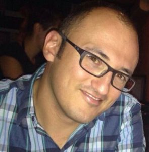
Dr Ing Brian Zammit
LARSOCS is more than a sum of its parts, however, and plans have already been laid to discover whether it will be possible for the drone to map underground buildings – making the use of a LPS rather than GPS all the more worthwhile.
“Along with some other colleagues, we have applied for funding to be able to have the drone map a series of underground water galleries that were once used for irrigation,” adds Dr Ing. Betts. “Nevertheless, it’s important that we first develop our own level of confidence with the system, and look into the legislation of flying a drone. What’s important to us, and the whole point of the project, remains that this technology needs to be made available to students across the various departments at the University of Malta.”
The project, which is expected to run for just over a year, has proven that when departments come together to work towards a common goal, everyone can benefit from it. And, as RIDT, we’re proud to be backing such a fantastic project!
You can be part of this fascinating world of research, too, by helping many others achieve their breakthroughs in all the faculties of the University of Malta. Please click here for more information on how to donate to research of this kind through the Research Trust (RIDT).